
Walk a Merrillville Street Trail
A sound Merrillville street directory search moves from the address to a parcel, then from the parcel to dated records. First standardize the street number, direction, name, suffix, unit, postal city, and ZIP. The county address-point layer and assessor can resolve small differences in spelling. Keep the data date beside the result. An owner name on a parcel card shows a deed or tax relationship, not who sleeps at the address.
Once the parcel identification number, or PIN, is known, it becomes the bridge between the map, assessor card, recorded documents, and older plats. Follow this order:
- Confirm the postal form and locate the address or PIN in the Lake County assessor search.
- Inspect the parcel and nearby address points in the county GIS layers.
- Use the recorded owner or legal description to search the Lake County Recorder index.
- Request a lawful voter-file search only when its rules fit the purpose.
- Take the dated address to library directories, maps, and newspapers for older household evidence.
Label every result by what it proves. GIS maps a point or polygon. The assessor lists parcel data. A deed records a transfer. A directory prints a name at a past date. That wording keeps a lead from becoming an unsupported resident claim.
Build an evidence log as the search moves. Give each row the address form, source, record date, access date, PIN, name as printed, and a verb such as “maps,” “owns,” “records,” or “mentions.” The verb prevents an assessor mailing address from silently becoming a home address. When rows conflict, keep both until the legal description or custodian resolves the mismatch.
Merrillville Street Directory Search Fields
The Lake County Assessor Engage portal accepts one owner, address, or property-number criterion. Choose an autocomplete match when offered, open the parcel, and record the displayed update date. Tabs may include Summary, Sketch, Transfer History, Sales List, Valuation List, Taxes, Land Info, Improvement Info, Neighborhood Amenities, Documents, Street View, and Forms.
| Search choice | Useful input | What to verify |
|---|---|---|
| Owner | Deeded name | Correct parcel and data date |
| Address | Number, direction, street | Situs and postal form |
| Property number | PIN from a bill or card | Legal description and transfers |
The assessor resources page says a parcel number may appear on a Notice of Assessment, property card, or tax bill. Its captured screen makes a useful start for a by-address search.
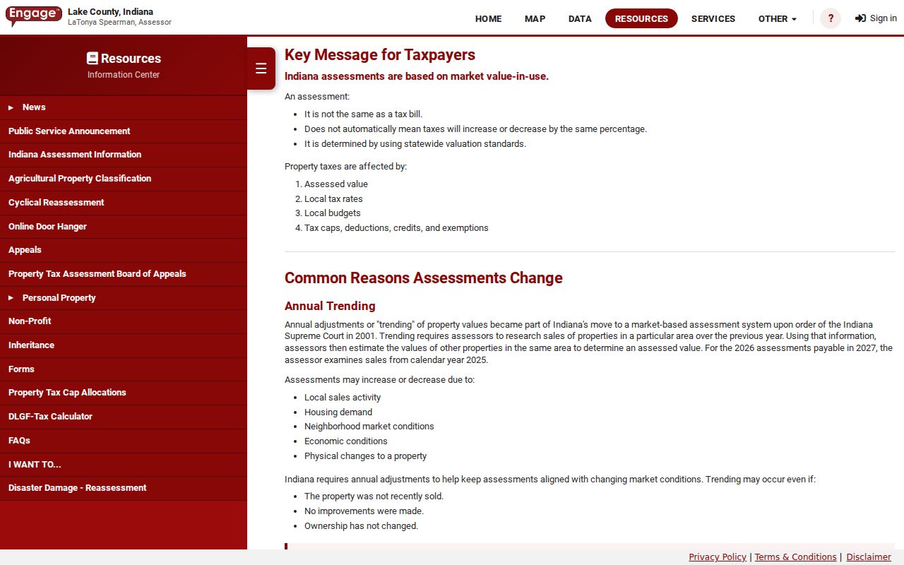
The screen supports a narrow, one-parcel workflow. It is not a roster of occupants, and covered-person names or addresses may be restricted.
Map Merrillville Streets and Parcels
The Lake County Surveyor GIS hub separates parcels, assessor data, and address points. The parcel layer includes a PIN, situs and mailing parts, legal description, acreage, property class, tax-set fields, and county links. The address-point layer includes the full address, postal community, ZIP, unit fields, and PIN. Queries cap at 2,000 features, so narrow them by street, municipality, parcel, or map area.
The parcel layer metadata exposes the fields behind mapped polygons.
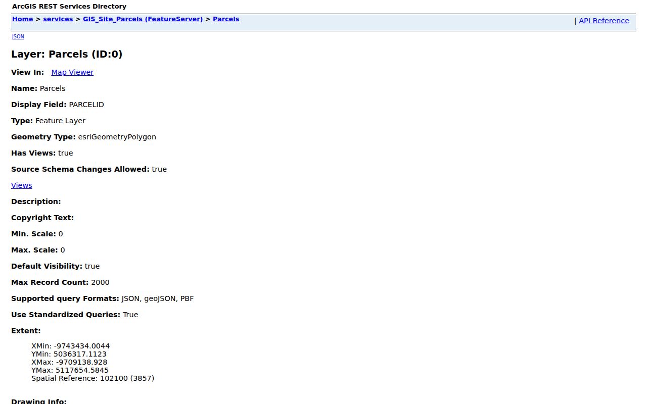
Those fields link a modern PIN to a legal description, but they do not establish occupancy.
The separate address-point layer helps when units or postal labels differ.
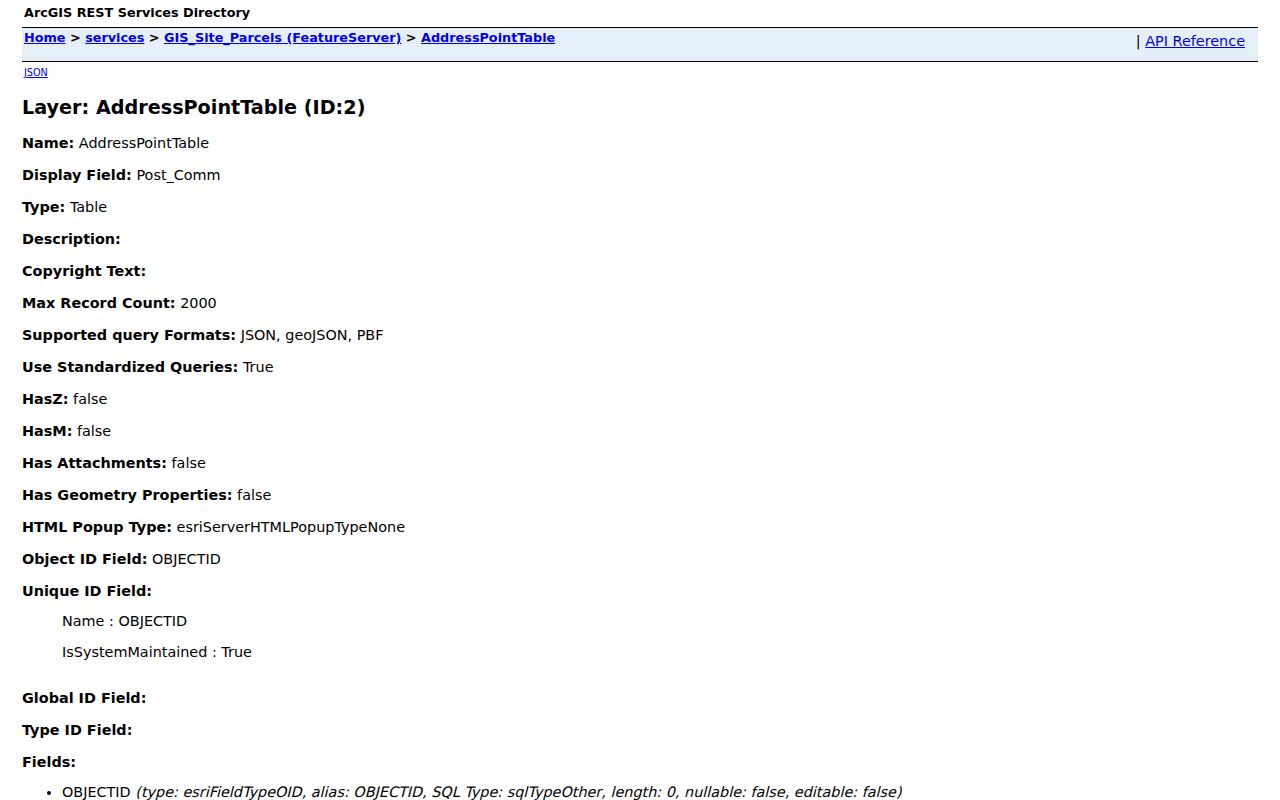
Compare the point with the parcel so a unit is not mistaken for the whole tract.
Merrillville Records Indexed by Address
No single Merrillville street directory captures every person. County offices sit in Crown Point even when the parcel lies in Merrillville, while town records cover municipal action.
| Record | Keeper | Street evidence | Access route |
|---|---|---|---|
| Parcel card | Lake County Assessor | Owner, situs, PIN, transfers | Online, phone, email, counter |
| GIS layers | County Surveyor | Shape, address points, legal fields | Hub, REST, office map request |
| Deeds and plats | County Recorder | Grantor, grantee, legal description | Portal, counter, phone or mail |
| Voter file | County Elections | Lawfully released fields | VRG-24 request under state limits |
| Zoning and permits | Town Planning | Land-use decisions and dated work | Town pages, minutes, APRA |
| Historic sources | LCPL and archives | Dated names, streets, maps, news | Online, visit, phone or email |
Bring a PIN, exact address, names, date range, and document type to a counter. When an online index fails, an office or archive may hold the older card, oversize map, microfilm, or image the web omits.
Follow Merrillville Deeds by Street
The Lake County Recorder keeps deeds, mortgages, liens, releases, leases, subdivision plats, and other instruments. Its portal describes one-line and field searching across more than three million documents and recordings spanning more than two centuries. Live searching needs an account, so authenticated fields must not be guessed.
Begin with the deeded owner, PIN, and legal description. Search name variants and a tight period. Confirm the document number, date, instrument type, grantor, grantee, lot or block, and image reference before buying pages. Images are listed at $1 per page plus a $3 order fee. At the Crown Point counter, ask about certified copies and missing instruments. A grantor conveys an interest; a grantee receives it. A plat maps lots or tracts.
A deeded owner may be a trust, estate, or company and may live elsewhere. Say “recorded grantee” or “deeded owner,” never “resident,” unless another dated source supports occupancy.
Merrillville Street Zoning Evidence
Town records add a civic layer. The Merrillville zoning page links planning resources, but research found no confirmed public permit index. Search dated minutes, then use the Town open-records channel for a named permit, zoning decision, plat, street record, or packet.
The captured zoning page shows the official route into land-use records.
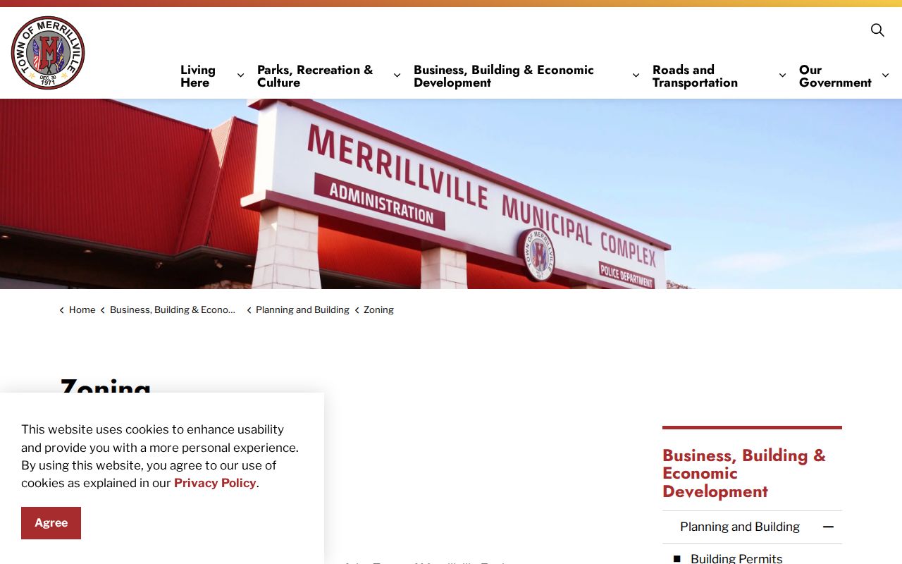
Its value is a dated government action, not an occupancy claim.
The Town also points to a zoning GIS map.
Compare the municipal layer with the county parcel record before drawing a boundary conclusion.
Merrillville Streets Cross Many Layers
Turkey Creek and Deep River, I-65, U.S. 30, Broadway or Route 53, and Taft explain local geography. They do not define parcel or postal bounds. Older records may use McGwinn Village, Wiggins Point, Centerville, Deep River, Turkey Creek, Ainsworth, Lottaville, or Rexville rather than Merrillville.
Use current GIS for a parcel and the Indiana State Library county guide for older context. No official town-wide street-renumbering project was found. If two numbers appear, preserve both with dates and ask Town Planning, the Surveyor, LCPL, or the historical society for a map or plat.
A street directory comparison should keep legal municipality, Ross Township, postal city, ZIP, ward, precinct, and parcel in separate fields. Lottaville is a useful warning because it once served as a U.S. Post Office address, yet an old postal name is not a modern town boundary. The State Library map holdings span property-owner maps, rural-delivery maps, atlases, plats, and a 2001 Merrillville map. Compare the map date with the deed or directory year. Roads can extend, parcels can split, and a mailing label can change while the land description follows a different chain.
That layered check also helps when the Merrillville street directory returns no exact spelling. Try the historical place name, directional variant, postal form, and legal lot or block, but record each as a tested variant rather than treating it as a confirmed match.
Note: A shared street name or ZIP is not proof that two records concern the same Merrillville parcel.
Voter Records Along Merrillville Streets
The Indiana Voters portal lets a person check status, polling place, ballot, and county contacts. It is not a public street roster. Broader records go through Lake County Elections and the VRG-24 process. Indiana excludes sensitive fields, restricts use, and does not make a county create a new report.
People in the Address Confidentiality Program may use a substitute address. Voter confidentiality and assessor restrictions create other gaps. A hidden address is a privacy control, not evidence that someone left Merrillville. Ask for the smallest existing record that answers a lawful family or civic question.
Merrillville Streets in Older Sources
The Merrillville Branch genealogy collection holds directories, newspapers, obituary indexes, maps, school indexes, yearbooks, and pamphlet files. A criss-cross directory is arranged by address instead of only by surname. It may place a printed household at a street in a stated year, but publication lag, omissions, and postal labels matter.
- Parcel
- A tract tracked by a county PIN.
- Situs address
- The physical location, distinct from the owner's mail address.
- Plat
- A recorded map of lots, blocks, or subdivisions.
- Criss-cross directory
- A directory arranged by street or phone number.
For deeper shelf work, use the Merrillville city directory collections. Cite title, year, page, and image, then confirm a key claim with another dated record.
Limits of Merrillville Street Records
Land records identify interests in property, not every adult, child, guest, or occupant. Utility data, motor-vehicle addresses, protected voter information, sealed records, and covered-person addresses are not street-directory material. Units can share a parcel, while an owner may receive mail elsewhere.
Lawful use. Use Merrillville address records for lawful family history, estate research, civic questions, or fraud prevention. Never use them to stalk, harass, threaten, or expose a protected person.
Record the source, date, exact field label, and limit. Verify a current claim with its custodian. A blank field should stay blank rather than invite a guess.
Commercial address tools may merge old phone, deed, and marketing data without showing the source date. Official records can also lag, but they identify the office, record type, and correction route. For a seller, heir, family-history, or civic question, that traceable chain is more useful than an unexplained match. If the evidence stops at a parcel owner, report exactly that and stop there.
Indiana APRA requests must describe an existing record with reasonable particularity. The Town or county need not answer questions, conduct research, or create a new street roster. Request a named permit, plat, instrument, map, or dated packet, and route it to the office that keeps it.